

Tripoli Seaport
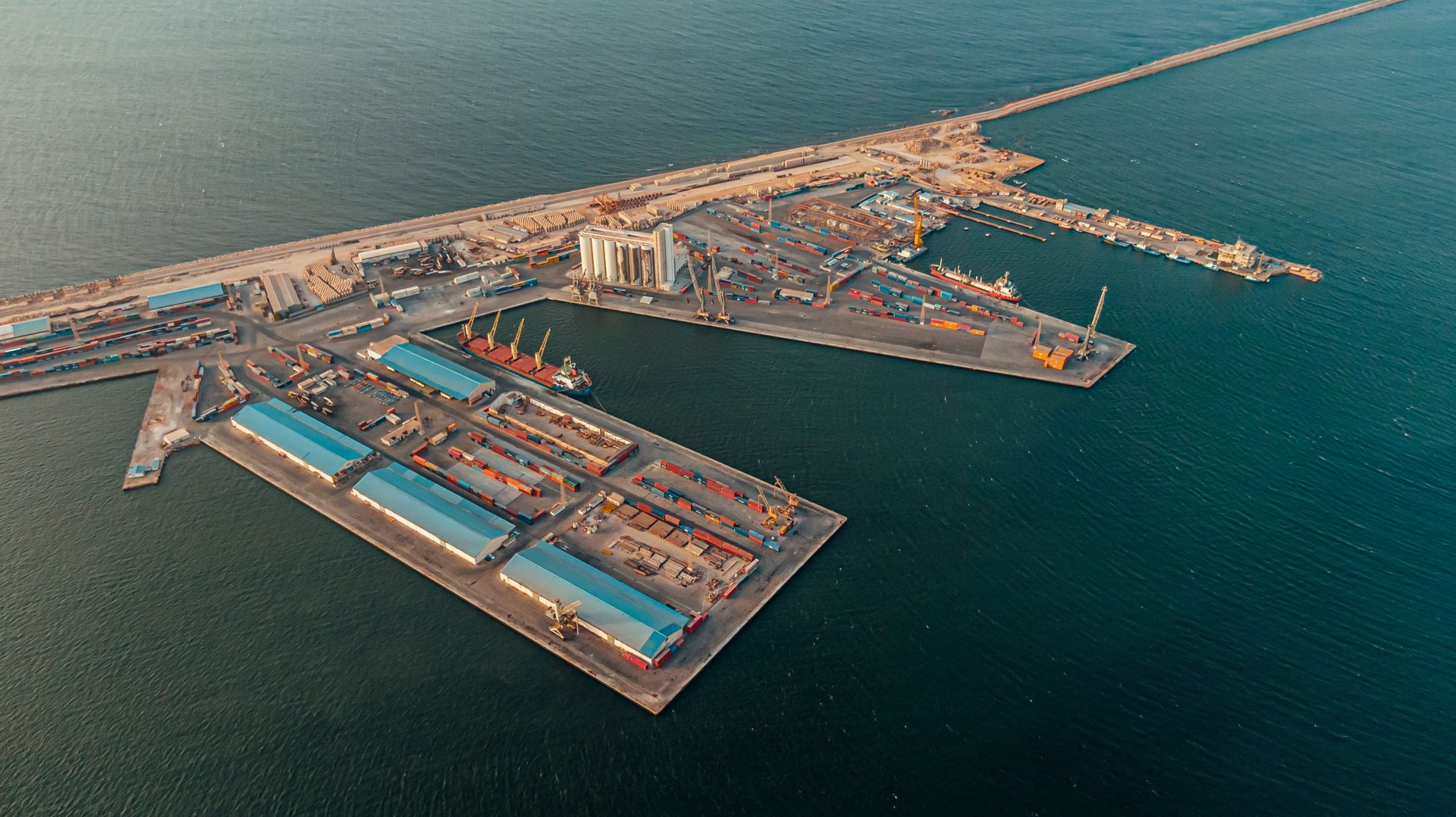
The Port of Tripoli, located in Tripoli, the capital of Libya, on the Mediterranean coast, is the largest Libyan port in terms of traffic and features a modern passenger terminal. The port covers a total area of 6,131,205 square meters and has been managed and operated since 1986 by the Libyan Ports Company, which manages all of Libya's commercial ports.
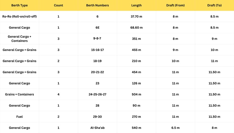
The port has 27 berths, including 18 berths for various types of cargo, 5 berths for roll-on/roll-off vessels (10-11-12-13-14), and three service berths. It also has a berth dedicated to the floating dock. The port's annual handling capacity is 4,500,000 tons per shift.
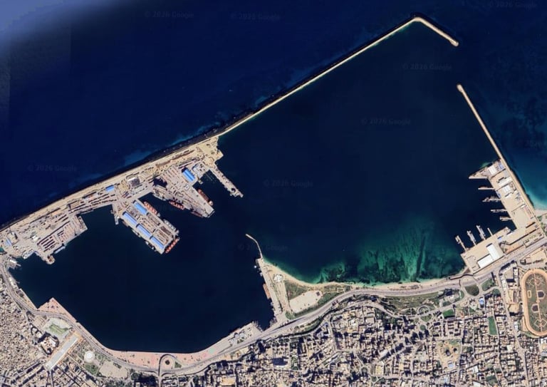
The first lighthouse in Tripoli's port was established in 1880.
The lighthouse immediately preceding the current one was built between 1924 and 1926. It was made of concrete and was destroyed during World War II in 1943.
The current lighthouse stands 116 feet above sea level and operates at night using a 220-volt electrical system. It is equipped with a 1000-watt lamp and has a beam range of 16 nautical miles. The lighthouse flashes three orange lights every ten seconds to help vessels locate the coastline at night. It also features black and white stripes to indicate the location of Tripoli's port during the day and to illuminate the area at night.
Location: Libya
Longitude: 13.13 East
Latitude 32.54 North
Port Features:
Total Area: 6,131,205 square meters
Water Area: 5,460,000 square meters
Land Area: 671,205 square meters
Design Capacity (Handling Capacity): 4,500,000 tons per shift (Phase 1 of the port).
For Cargo: (Direct Delivery - Unspecified) Approximately 8 million tons.
For Containers: 500,000 TEUs (Twenty-Four Thousands) (Phase 1 of the port).
Maximum Vessel Capacity: (Not exceeding 40,000 tons, with a draft not exceeding 11 meters, and a length sufficient for maneuvering).
Operating Hours:
- Bulk Cargo: 24 hours (All types, direct delivery).
- General Cargo: 12 hours (direct delivery).
Navigational characteristics:
The channel is 2.5 nautical miles long, 250 meters wide, and has a minimum depth of 12 meters.
The sea entrance to the port is 200 meters wide.
Pilotage and towing services are mandatory for all vessels.
The seabed in the anchorage area is sandy and 25 meters deep.
The anchorage area coordinates are between longitudes 13.11.7 and 13.09.8 East, and between latitudes 32.56.5 and 32.55.5 North.
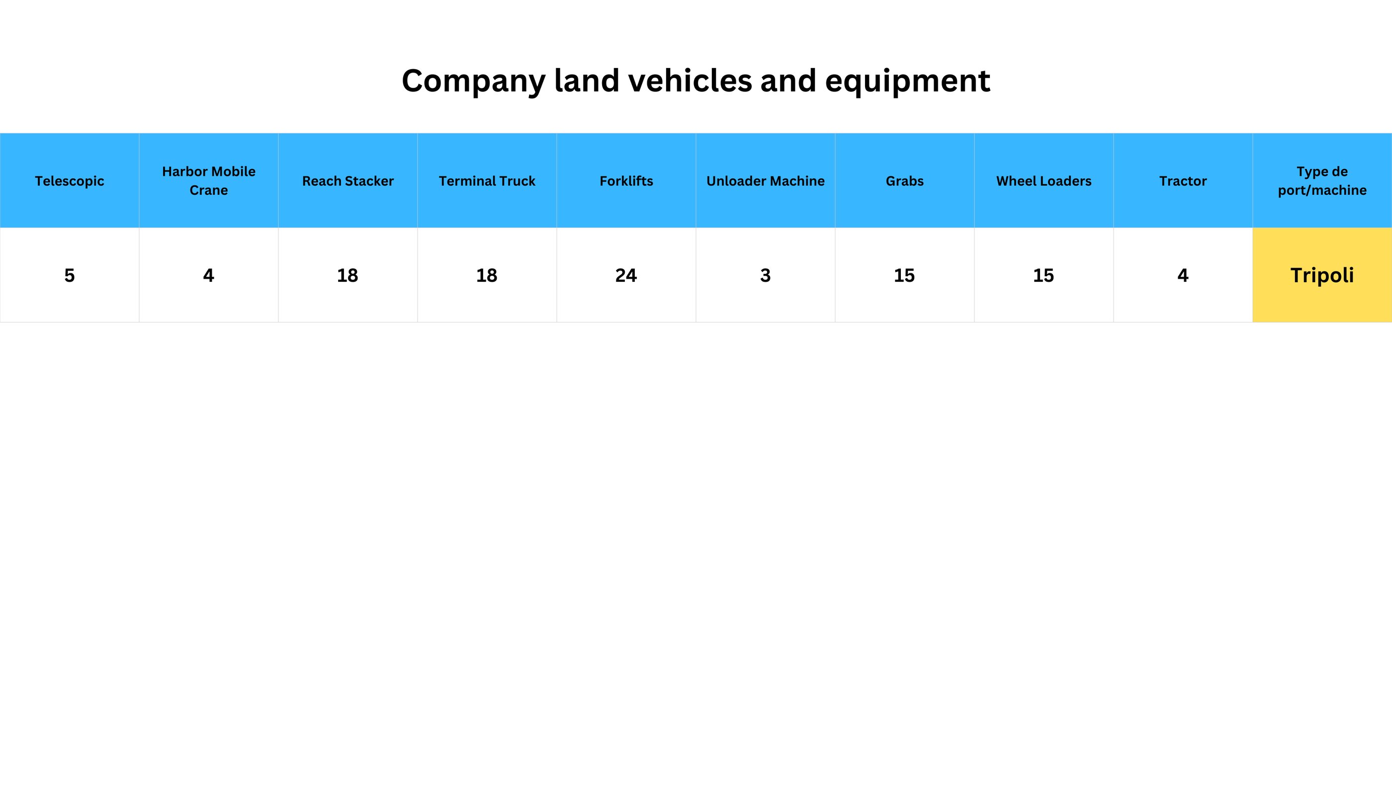
Platform characteristics:
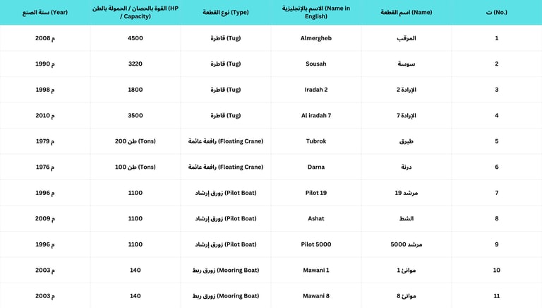
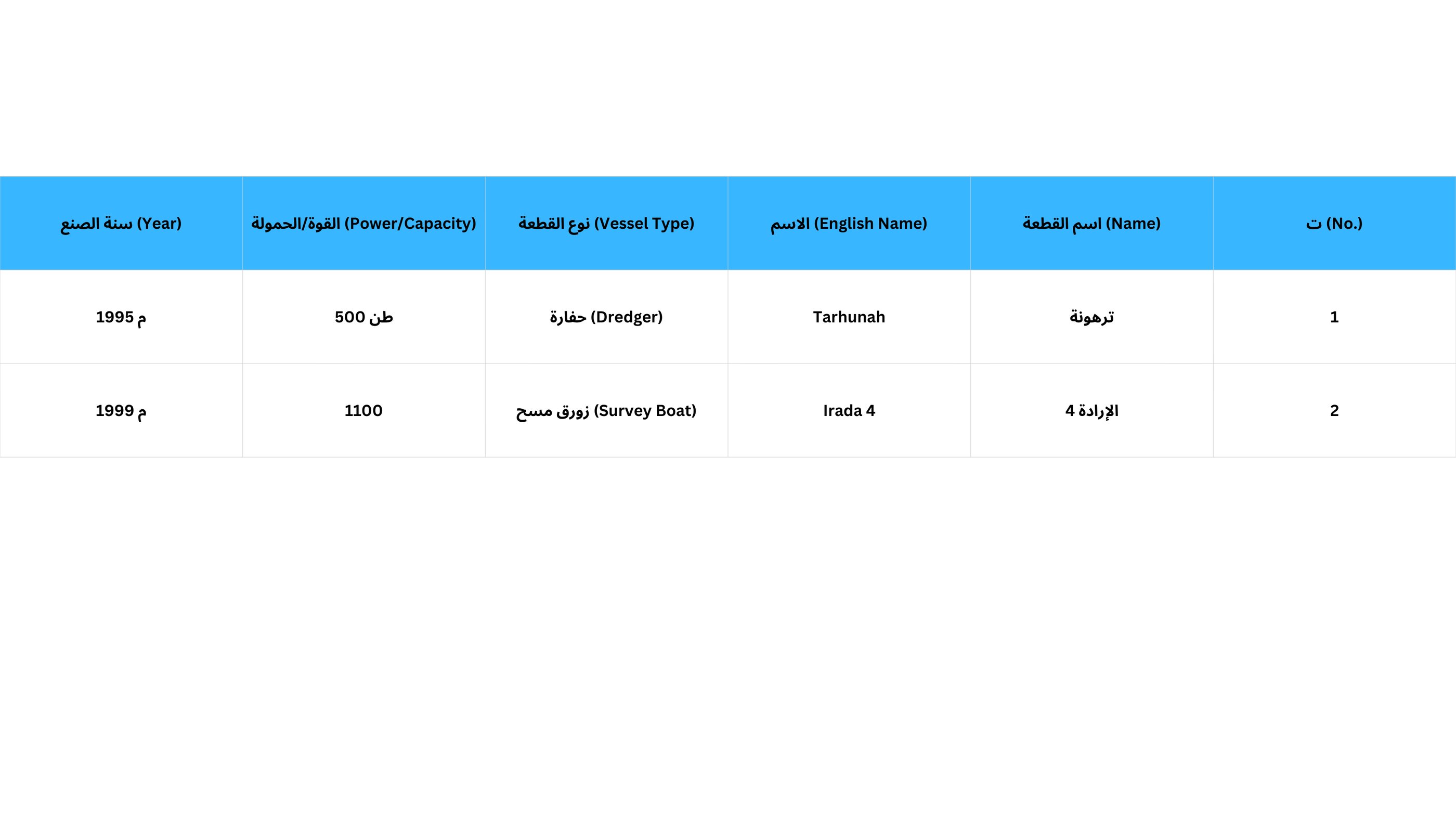
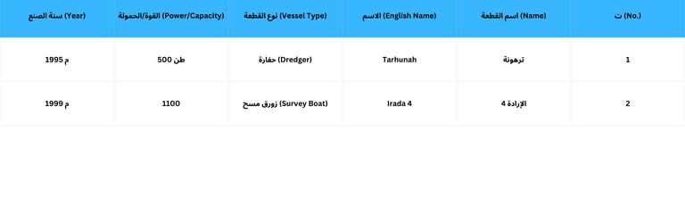
Distribution of marine units in the port: