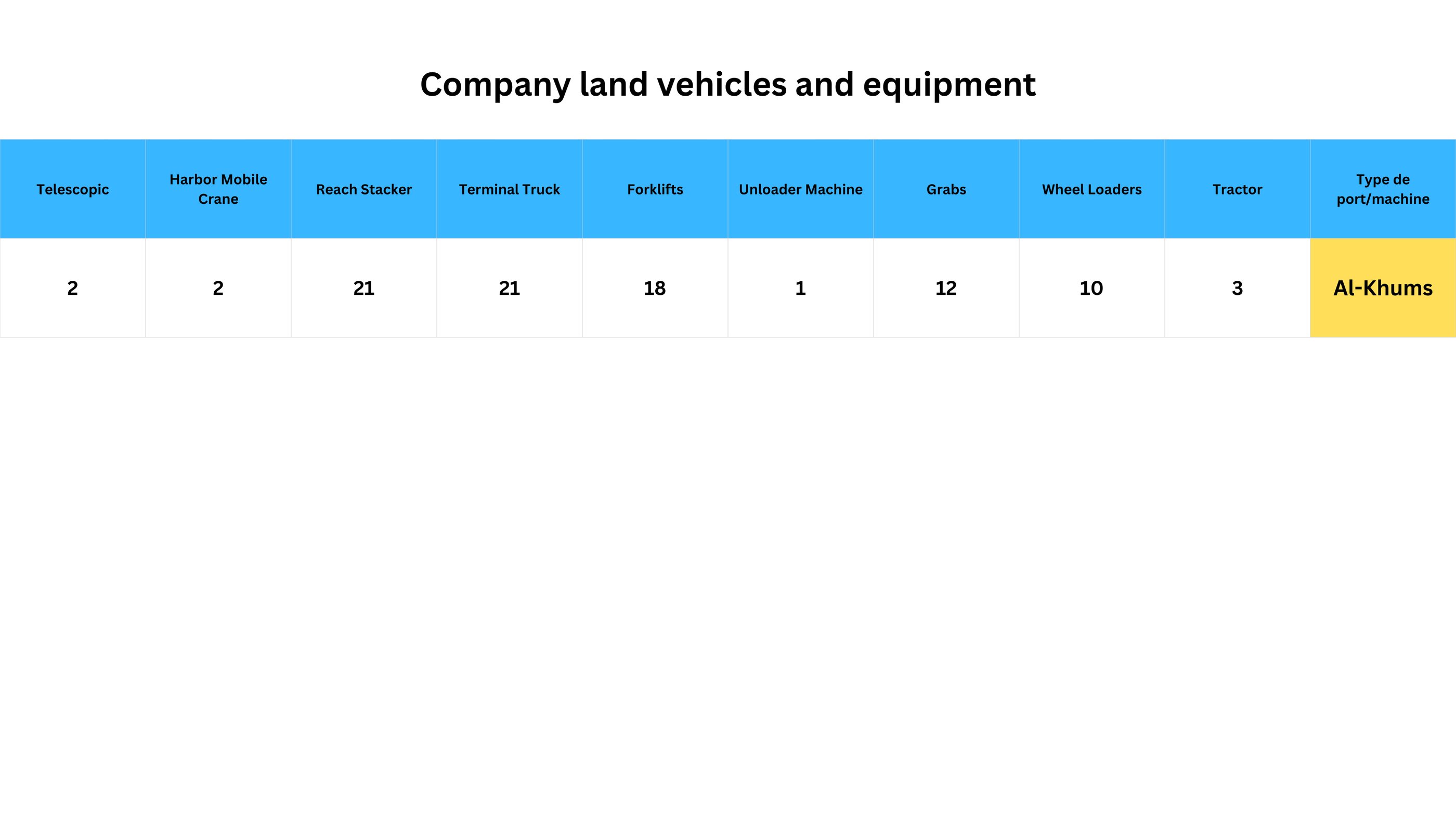


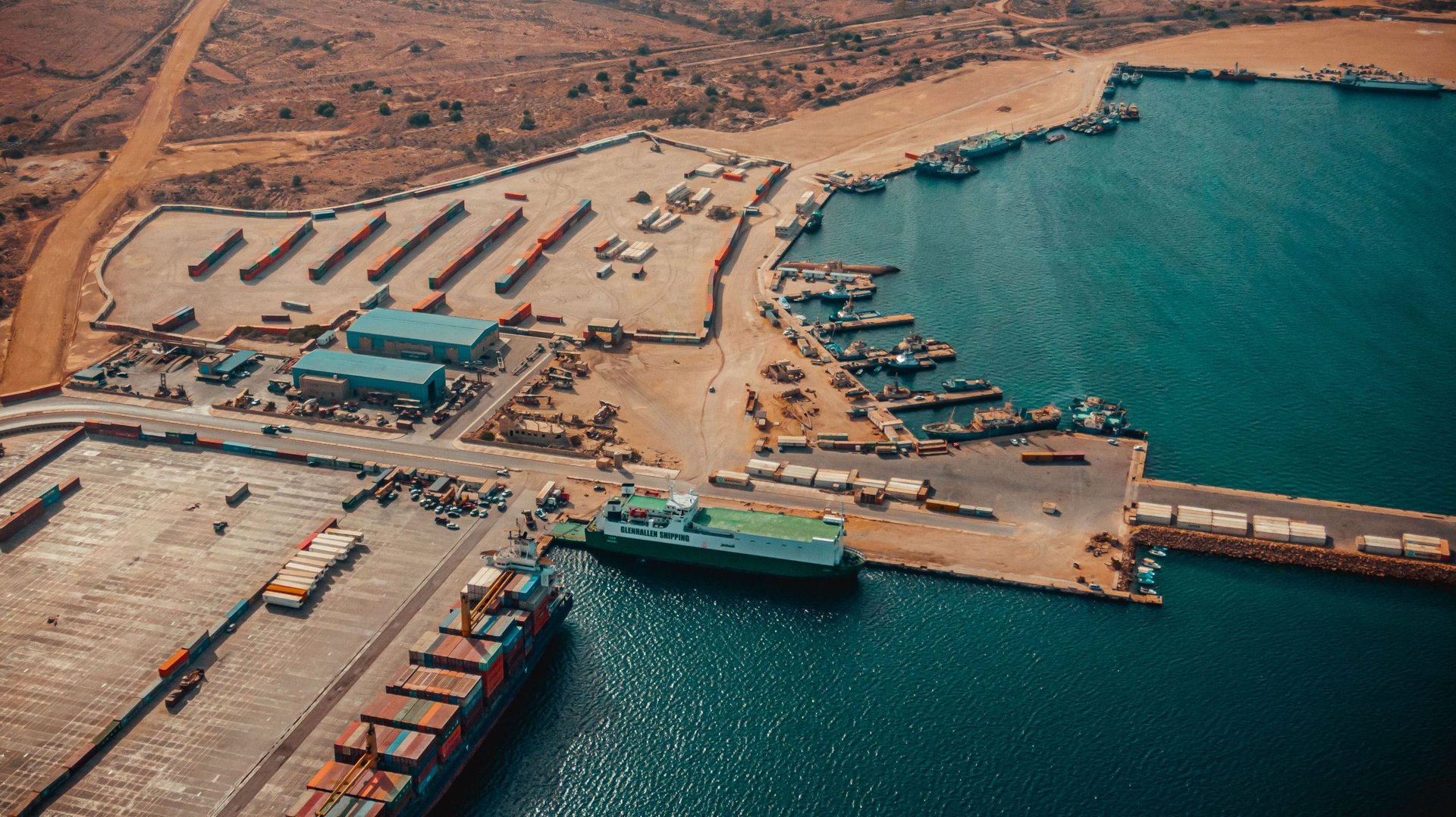
Al-Khums Seaport
The port of Al-Khums is located in northwestern Libya, 2.5 km west of the city of Al-Khums and 120 km east of Tripoli (the capital). It is considered one of Libya's major ports and facilities due to several advantages, including its location, storage areas, potential for expansion, considerable depth, and long quays.
The port of Al-Khums is characterized by a natural rocky seabed, which reduces the need for landfill in the basin and navigation channel. It also boasts suitable natural depths. Easy connection to the main coastal highway (Al-Khums-Tripoli) and the ongoing construction of a railway line from the port to neighboring areas, linking it to the national rail network, will facilitate the transport of goods and foreign trade.
Furthermore, the port's proximity to the iron and steel complex in Misrata and the cement factories in Al-Khums reduces transportation costs. Its proximity to the ancient city of Leptis Magna and the Villa Selene also enhances its appeal as a tourist destination.
Location: Libya
Latitude: 41.32 North
Longitude: 15.5 East
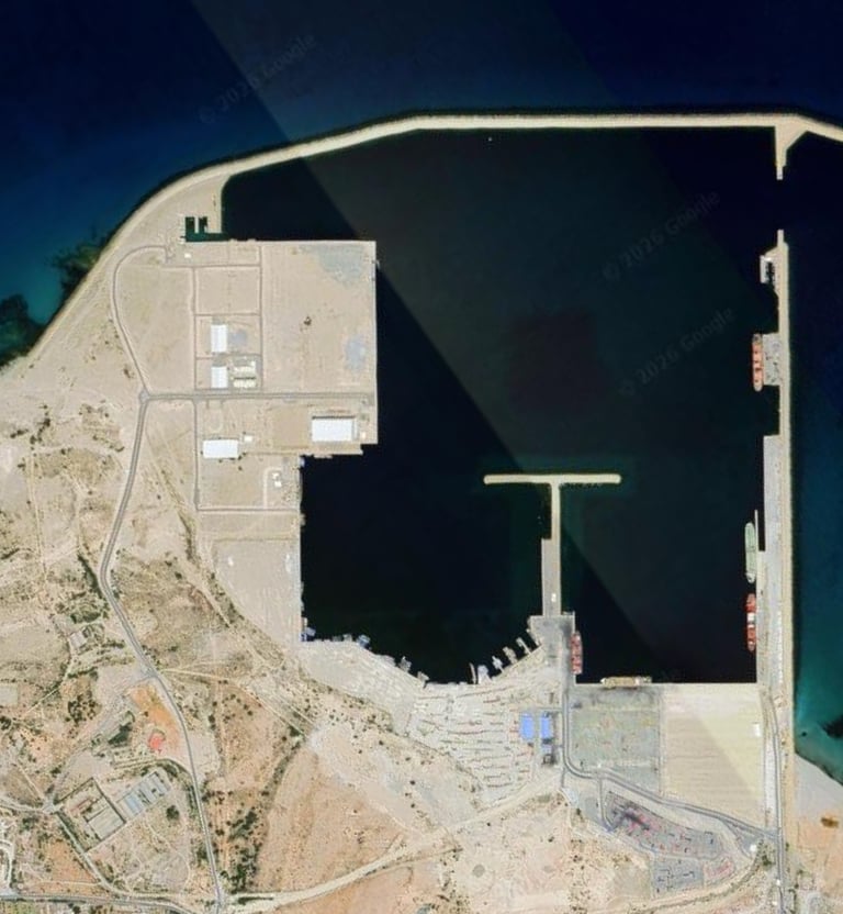
Port Features:
Total Area: 249 hectares
Water Area: 102 hectares
Land Area: 147 hectares
Design Capacity (Handling Capacity): 1 million tons per year
General Cargo: 35,000 tons
Liquid Cargo: 100,000 tons
Non-Bag Cargo: 450,000 tons
Refrigerated, Frozen, or Sanitary Cargo: 35,000 tons
Vehicles and Machinery: 10,000 vehicles
Passenger Ports: Passenger capacity available
Container Ports: 350,000 TEUs (Twenty-foot equivalent units), expandable upon completion
Maximum Vessel Capacity: 35,000 tons with a draft of 11 meters
Operating Hours: 24 hours Navigational characteristics:
Channel length: 1 nautical mile, width: 250 meters, depth: 14–20 meters.
Turning point (diameter: 500 meters, depth: 13 meters).
Approach zone (directly from the sea).
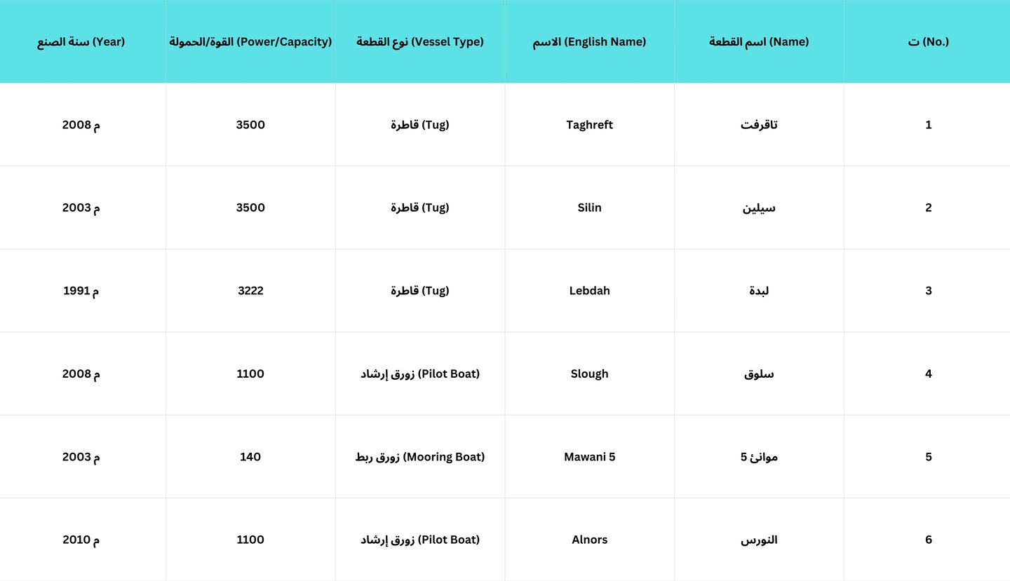
Pilotage (mandatory for all vessels).
Towing (mandatory for all vessels).