

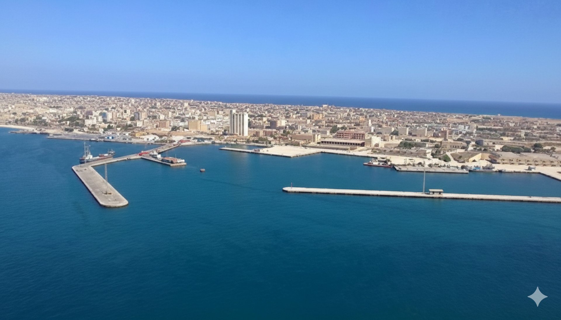
Tobruk Seaport
رThe port is located in the northeastern part of Libya, near the port of Tobruk. It is the only natural harbor on the Libyan coast, situated within a bay of approximately 6 square kilometers. This bay acts as a shelter from waves and strong winds, and is typically swept by easterly winds in December and March.
The bay extends approximately 4 nautical miles inland and has considerable depth.
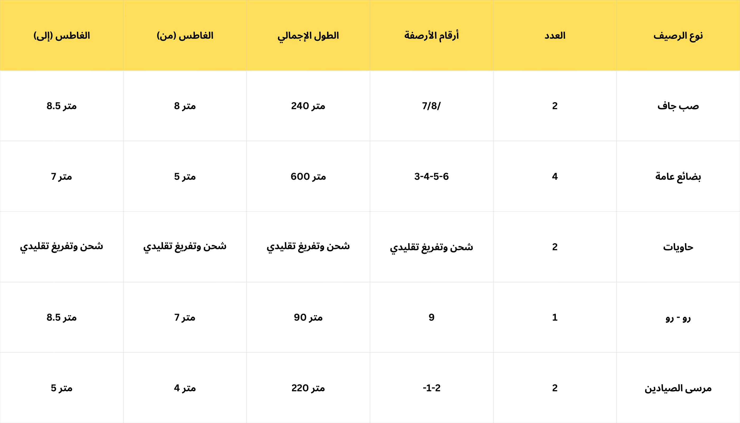
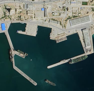
The commercial and marine port is located on the northwestern side of the bay, while two berths used for loading and unloading bulk liquids (oil) are situated on the southeastern side.
Location: Libya
Latitude: 5.32 North
Longitude: 59.23 East

Port Features:
Total Area (680,000 sq m)
Water Area (480,000 sq m)
Land Area (200,000 sq m)
Design Capacity (Handling Capacity) (1,070,000 tons per year)
For Cargo:
General Cargo: 500,000 tons per year
Dry Bulk: 400,000 tons per year
Container Cargo: 150,000 tons per year
Container Cargo: 20,000 tons
Largest Vessel Capacity (50,000 tons)
Operating Hours:
24 hours daily, divided into shifts.
Navigational Characteristics:
Water channel length: 2.3 nautical miles, width: 350 meters, average depth: 15 meters
Turning basin (580 meters in diameter and 15 meters deep at oil berths, and 360 meters with an average depth of 7 meters at commercial marine berths).
Approach zone (from the north, the city's outskirts are visible, and from the south of the bay, a range of moderately high mountains and navigational lights guide vessels).
An anchorage area located 2 nautical miles east of the bay entrance.
Pilotage (mandatory for all vessels).
Towing (mandatory for all vessels exceeding 2,000 tons).
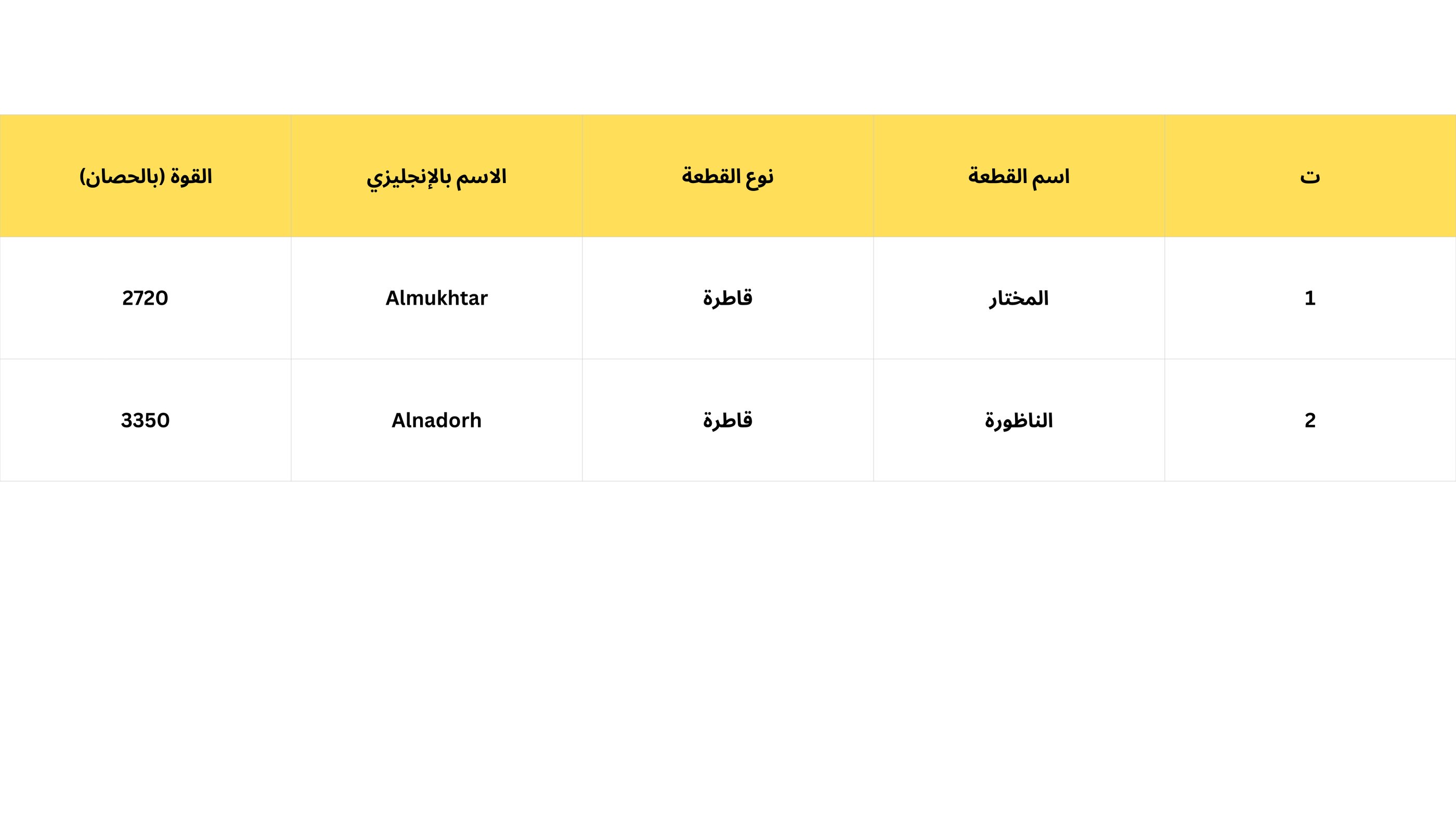
Distribution of marine units in the port:
Platform characteristics: